The data used to generate this site's forecast track images are in a compressed comma-separated value format that is not straightforward to use. To aid end users who wish to incorporate these data into their own dynamic maps, we convert these data into GeoJSON-formatted data. Similarly to the shapefiles produced by this website, these files are configured to depict each model's track as a uniquely named LineString. Like the KML data and unlike the shapefiles, however, individual positions and intensity information every 12 h along each model's track are included as part of the shapefiles.
GeoJSON data are currently only available for the "early" guidance data for the most-recent model cycle. These files are available from the "GeoJSON Output" option in the drop-down menu for each active storm on the website's front page. Archived versions of the "early" guidance data are available in each storm's archive beginning in September 2026. This archive can be accessed through the "Archived Maps" entry in the drop-down menu for each active storm or from the site-wide archive linked in the navigation menu above.
You are welcome to download and import these files into any code, program, or website that accepts GeoJSONs as input for personal use. All other uses - such as using them to drive a real-time display on your website - require approval. We typically allow such uses so long as credit is given, but please contact us with your proposed use case to learn more.
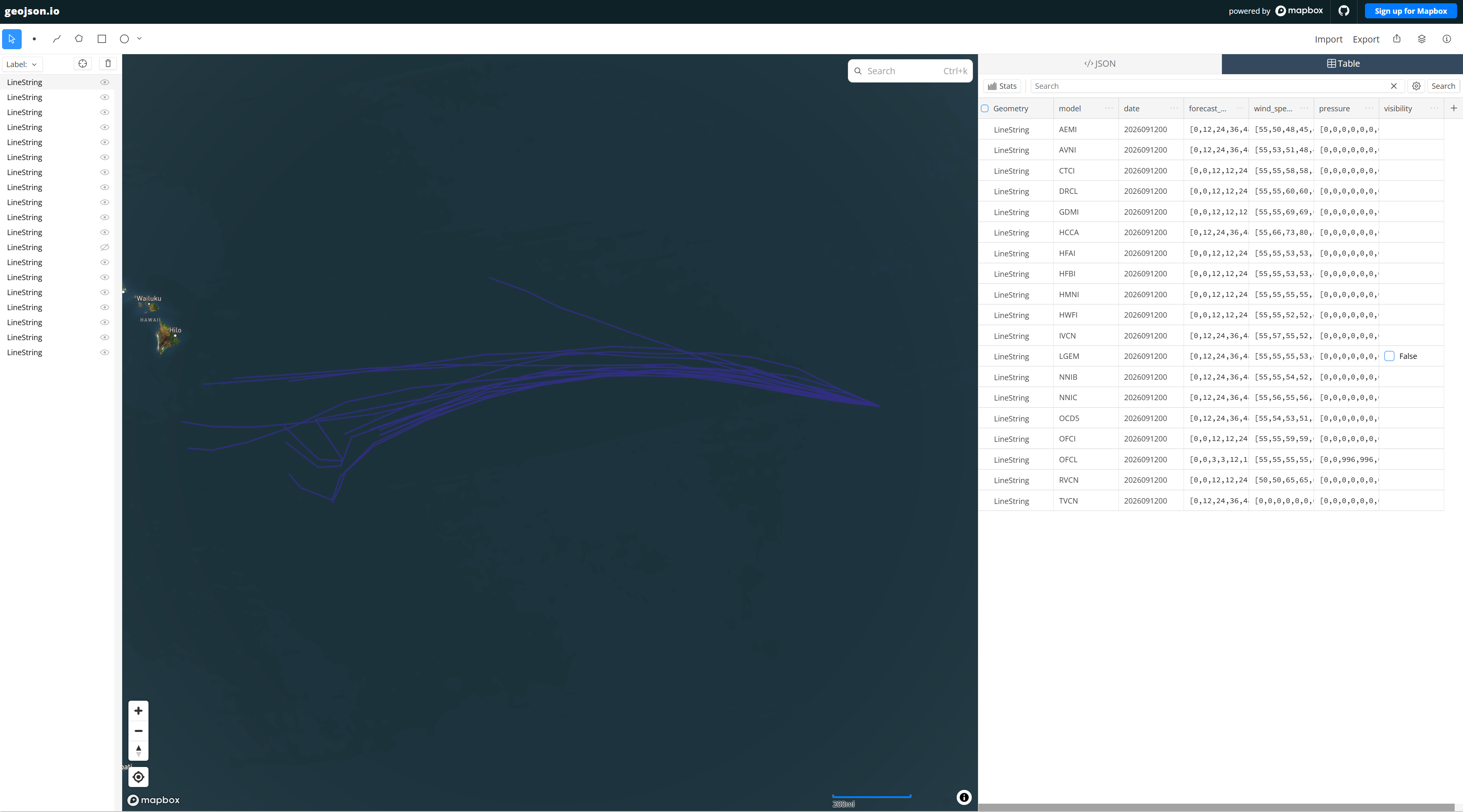
Above: geojson.io (powered by Mapbox) visualization of GeoJSON-based "early" guidance for E. Pacific Tropical Storm Norbert (2026) on 12 September 2026. Note the visualization of the tracks, with the associated timing and intensity information in the table at right.