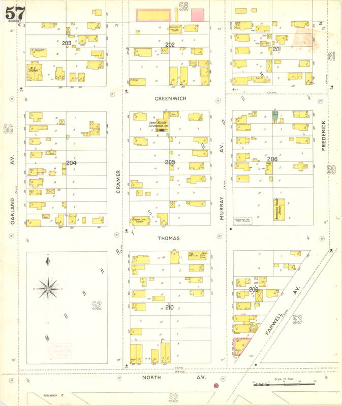
This Sanborn map shows the second location of Westminster Presbyterian Church, where the mission would formally organize as a congregation and build a structure at the corner of Thomas St. and Frederick Ave.
Find related items in the Westminster Presbyterian Church collection.
- Christianity
- Church Growth
- Mainline Protestantism
- Map
- Murray Hill Neighborhood
- Presbyterian Church (U.S.A.)
- Westminster Presbyterian Church
- Source: Sanborn Map Company. Milwaukee, Milwaukee County, Wisconsin, 1894. New York: Sanborn-Perris Map Co. Limited, 1894. "Sanborn Fire Insurance Maps." http://collections.lib.uwm.edu/digital/collection/san/id/68 (Accessed February 19, 2018).
- Creator: Megan Kautz and Anna Vodenlich
