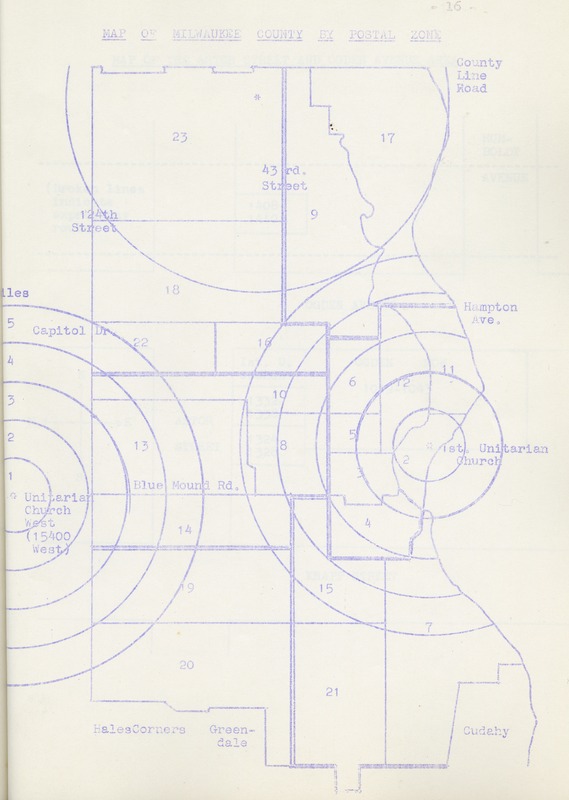
A map of Milwaukee postal codes used by the First Unitarian Planning Committee in the "Report on the Basic Policy Concerning Our Current Church, 1962" to display the distribution of congregations and communities proposed and existing Unitarian churches would serve. The report was created in response to congregational growth and spread of Unitarianism in Milwaukee with population movements to the northern suburbs and cities to the west of Milwaukee.
Find related items in the First Unitarian Church of Milwaukee collection.
- Brookfield, WI
- Church Growth
- First Unitarian Church of Milwaukee
- Map
- Unitarian Universalism
- Unitarian Universalist Association
- Yankee Hill Neighborhood
- Source: First Unitarian Society Records, 1841-2017. UWM Manuscript Collection 175, box 8, folder 6. University of Wisconsin-Milwaukee Libraries, Archives Department.
- Creator: Brennan Christianson and Roman Lulloff
